


A Bit of History
1823 Vignoles Map of Florida
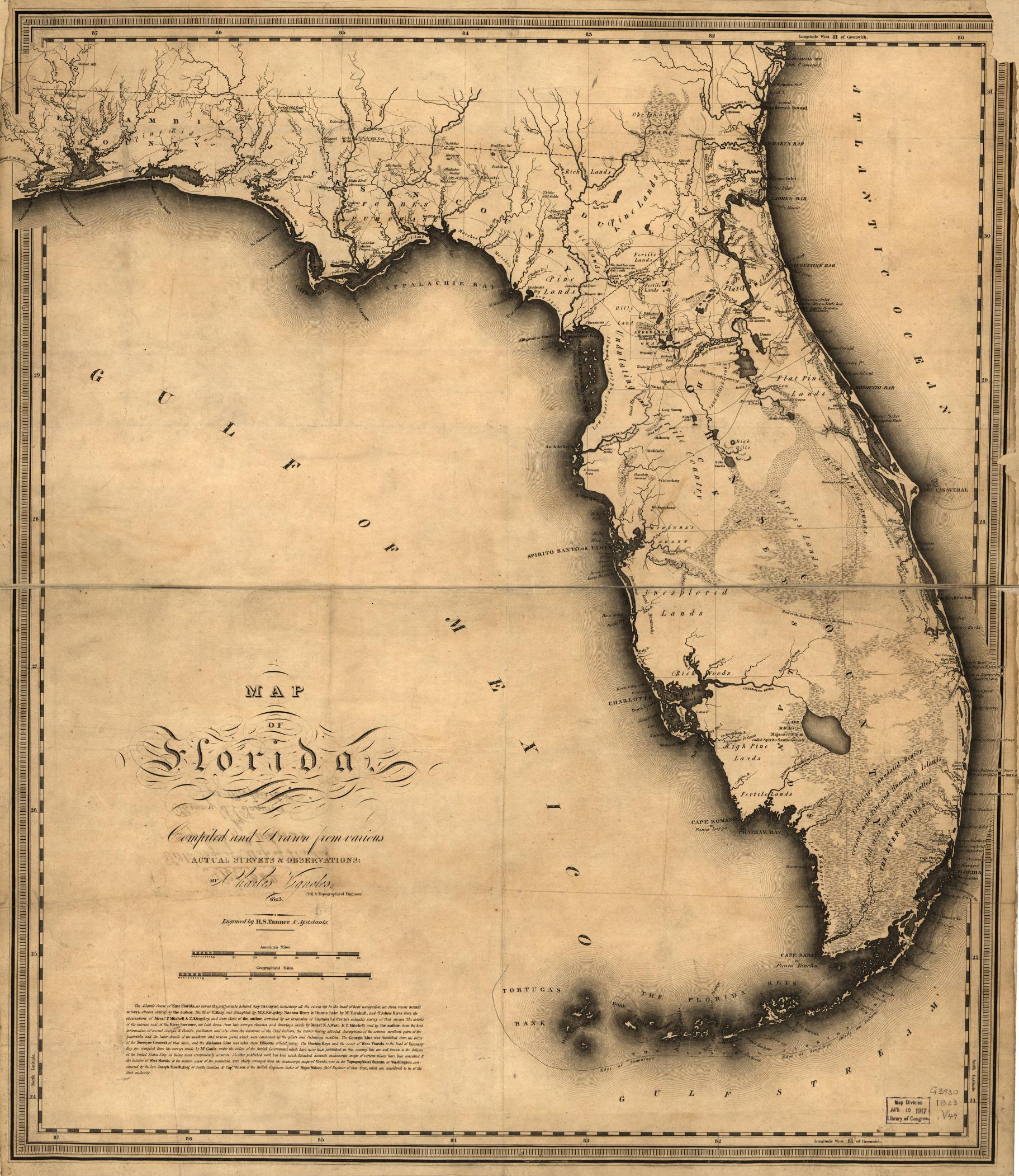
In 1823 Charles Blacker Vignoles published a map of Florida along with a book, Observations on the Floridas, that provided additional details about Florida that he obtained from his survey expeditions. The 1823 Vignoles map was first map to show Florida as an American territory and served as the basis for many subsequent maps of Florida for several decades. Born in England, Vignoles served in the British army before traveling to the South Carolina where he was appointed assistant to the South Carolina Surveyor General after which he traveled to St. Augustine in 1821.
Charles Vignoles born in 1793 in Ireland, arrived in Charleston in 1817 where he took a job as Assistant to the South Carolina Surveyor General. Soon after arriving, Vignoles established a surveying office which was located in Charleston at the corner of Anson and Guignard streets. Vignoles ran regular advertisements for his business in The Charleston Daily Courier.
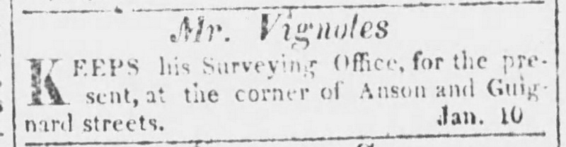
The Charleston Daily Courier, January 11, 1821
In June of 1818 he moved out of Charleston to avoid the fever prevalent in the summer months and made arrangements to have a two room quarters at Fort Moultrie on Sullivan’s Island.
With the recently acquired Florida Territory there was a considerable need for surveyors to resolve land claims. Vignoles saw this opportunity and in June of 1821 embarked for St. Augustine and he wasn’t disappointed for The Minutes of the City of St. Augustine for July 30, 1821, record his appointment as City Surveyor. Then in November of 1822 Vignoles, being fluent in the French and Spanish languages, was appointed Public Translator and Interpreter in St. Augustine by the Governor of East Florida. There was considerable need for a translator due to the large number of Spanish land grant documents held at the Land Office in St. Augustine.
Florida, after newly becoming a U.S. territory in March of 1822, was in desperate need to have an accurate map to determine what land was privately owned, what was government land, and, to accurately show waterways and other land features that could be useful for transportation and settlement. Soon after arriving in St. Augustine, an official of the Land Claims Commission of Florida suggested that Vignoles should produce such a map.
In 1822 Vignoles made two expeditions surveying and exploring Florida. The first expedition began in February 1822 where he surveyed the east and southwest coasts, including the Florida Keys. The second quickly followed in which he mapped the interior. Vignoles provides only a brief notes of Alachua saying,
The great Alachua savanna is the most considerable, being but seldom entirely free from water. Many curious stories are circulated among the Indians respecting a whirlpool, where a subterraneous discharge of water is said to take place ; but the author has not been able to ascertain the fact.
Vignoles does not mention visiting Wantons but he does mention Micanopy saying,
The paths through this portion of Florida are numerous: the main routes from the Suwanee meet in the centre of the Alachua at the town of Micanopy, on the northern bank of Taskawilla [Tuskawilla] lake; from hence which was the antient capital of the Indian nation, the tracts diverge in all directions to Black creek, Picolati, Vibrilia and Buffalo bluff on the central parts of St. John’s river: routes also go down to Tampa bay through the chain of Indian villages and settlements, and to the lower crossing places over the Ocklawaha by way of lake Ware [Weir], and hence a path leads to Volusia on the St. John’s above lake George.
The paths from Micanopy are shown on his map. Vignoles also mentions the Arredondo Grant in the center of Alachua and shows it centered upon the town of Micanopy, a feature copied by many following maps for years but would later prove to be incorrect. The center of Arredondo Grant was later determined by the US Supreme Court to be the Alachua Sink which Vignoles never visited.
After completing his surveys in Florida, Vignoles returned to Charleston aboard the Schooner William-Henry on July 26, 1822 after a 29-hour voyage from St. Augustine. Also aboard was “Mr. Levy which could have been Moses Levy or his son David Levy.[1]
Upon returning to Charleston, Vignoles needed to have his new map of Florida engraved and published to which he turned to the prominent cartographic publisher and engraver Henry Schenck Tanner located in Philadelphia, Pennsylvania. On August 27th, 1822 while traveling on a train from Charleston to Philadelphia the train overturned and, “The vehicle was demolished entirely.” Vignoles “had the whole of his left side much hurt, particularly the arm, which was stripped of the skin and greatly injured.” Even with his injuries, after finishing his business in Philly, he continued on and arrived in New York a few days later. It was reported in the same article that on the same evening another coach on the same line was “over set close to new Brunswick; and a third overthrow took place of a stage belonging to another line. On Tuesday evening one of the Baltimore and Philadelphia Union stages was likewise overturned.” It seems that travel was precarious at the time.
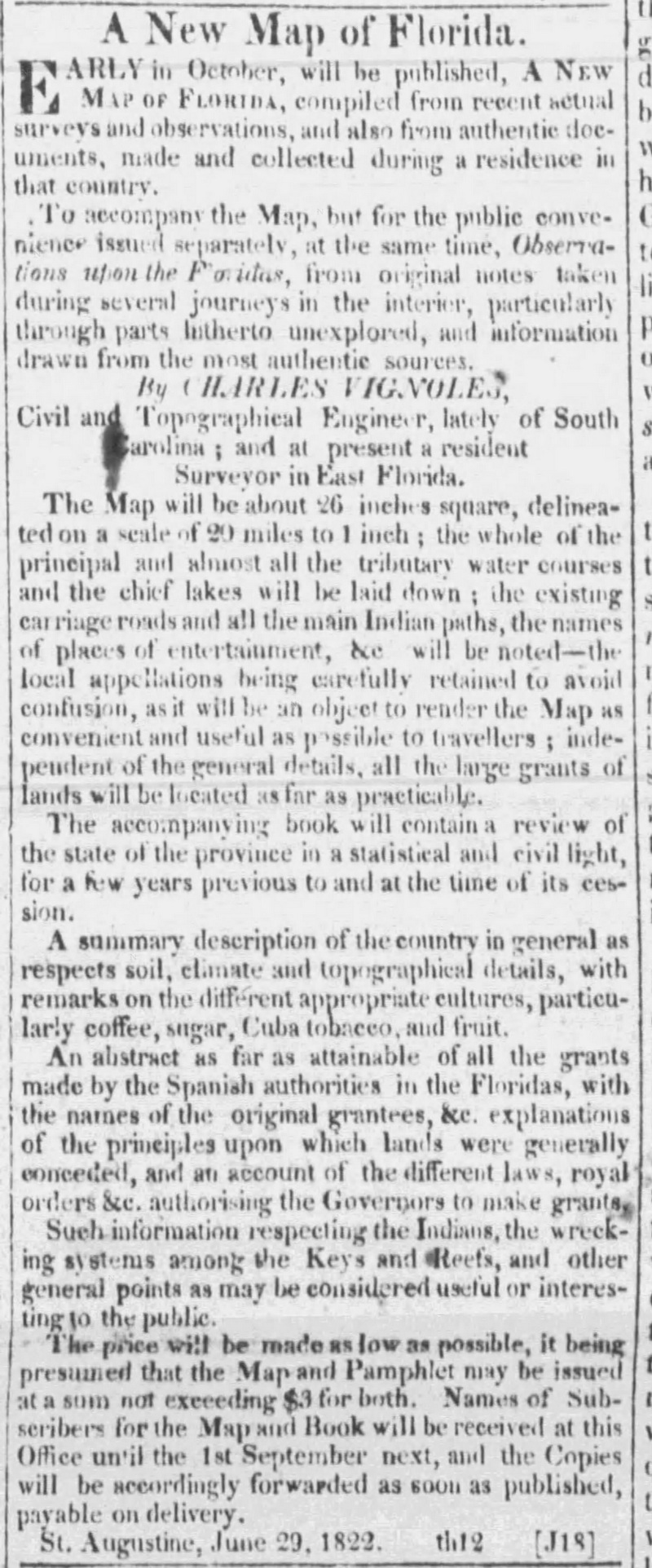
With his new map of Florida and book Observations upon the Floridas soon to be published, Vignoles begin running advertisements in the Charleston Daily Courier.
July 23, 1822
Vignoles’ map was published in Philadelphia in 1823. In the same year, Vignoles published a topographical memoir of his expeditions titled “Observations upon the Floridas”. Which sold for $1.50 while his map sold for $2.50.
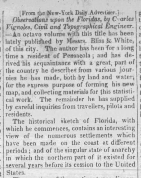
The Charleston Daily Courier, Apr 4, 1823, p2
The Vignoles map captured a snapshot of the newly created Florida Territory. Among its many distinctions, Vignoles’ map is the first to name the Everglades and the first to locate a settlement at the site of Miami (“Cape Florida Settlems.”) The map is rich in place names, notations, and descriptions of the land, such as “Alachua Savanna”, “Pithlachuca Lake”, “Fertile Lands”, and the natural land bridge of the Santa Fe River, “The River here runs subterraneous for 3 miles”. In his book he describes it in more detail:
Observations upon the Floridas, p64
We pause an instant here to mention the singular circumstances of the Santaffy river, some considerable distance from its junction with the Suwanee, sinking into the earth and rising again at a distance of three miles: this pace is call the Natural bridge, and her an Indian path crosses - it is stated that in time of high freshets, the space above the subterraneous channel is inundated, and that on those occasions a parallel current runs over it…
Of course the land bridge was nothing new, William Bartram had traveled the same route and made similar notes about his travels in 1774. Vignoles acknowledges Bartram when he writes about a nearby spring, “A few miles below the White Kings old town on the Suwanee, upon the left bank, is the spring mentioned by the younger Bartram in his travels, wherein the manatee or sea-cow is often seen and sometimes caught.” with the spring labeled Manatee Spring on his map.
Vignoles goes into more detail about the Alachua area describing, “Lake Pithlachuccco and Orange Lake are as many parts deep….” and “The great Alachua savanna is the most considerable, being but seldom entirely free from water.” But curiously, Vignoles does not visit the eye of the Alachua Savana, the Great Sink, something that Bartram describes so well. Vignoles treats the sink like some local folk story when he says, “Many curious stories are circulated among the Indians respecting a whirlpool, where a subterraneous discharge of water is said to take place; but the author has not bee able to ascertain the fact.” The Alachua Sink was then, and still today, on the north side of the Paynes Prairie.
[1] 1822_09_03,The_Charleston_Daily_Courier_p1,Vignoles
Updated: 08-06-2026