


A Bit of History
1823 Vignoles Map of Florida
All Paths lead to Micanopy
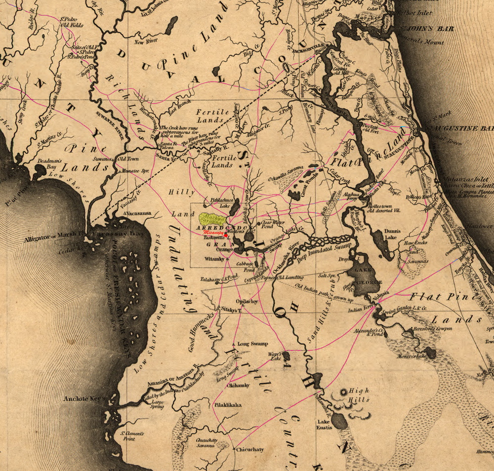
Inidan paths highlighted
Click to see larger map
Vignoles inland expedition followed many of the same paths as traveled by Bartram fifty years earlier, mostly Indian trails which Vignoles recorded on his map. These trails had changed little since Bartram time although a new 45 mile road from Micanopy to Picolati (Palatka) would be completed in February of 1823, just before Vignoles map would be published. Micanopy and Wantons trading post were the key central settlements in central Florida and all roads led though it. As seen on Vignoles map and described in his book…
p.79
The paths through this portion of Florida are numerous – the main routes from the Suwanee meet in the centre of the Alachua to the town of Micanopy, on the norther bank of Tascawilla Lake; from hence which was the antient capital of the Indian nation, the tracks diverge in all directions, to Black creek, Picolati, Vibrilia and Buffalo bluff on the central parts of the St. John’s river – routs also go down to Tampa bay through the chain of Indian villages and settlements, and to the lower crossing places over the Ocklawaha by the way of lake Ware (Weir), and hence a path leads to Volusia on the St John’s above lake George.
In 1825 Indian paths were the superhighways of the interior of Florida with Micanopy being at the main intersection. Vignoles complains about the mail from Pensacola taking some longer route when it would be more efficient going though Micanopy which would bring the mail from the Suwanee to St. Augustine in just three days.
Another feature of Vignoles’ map was it showed major Spanish land grants that were made within a few years before Spain ceded Florida to the United States. This was of significance because there was some question of these “last minute” grants being valid, particularly since the grants contained some of the most desirable land. One of the largest grants, and the most significant to my story, was the Arrendondo Grant. Granted to Don Fernando De la Maza Arrendondo and son on December 22nd, 1817, it consisted of 289,645 acres in the area of Alachua which contained fertile lands for farming and the vast Alachua Savana which was ideal for raising cattle.
Updated: 08-06-2026