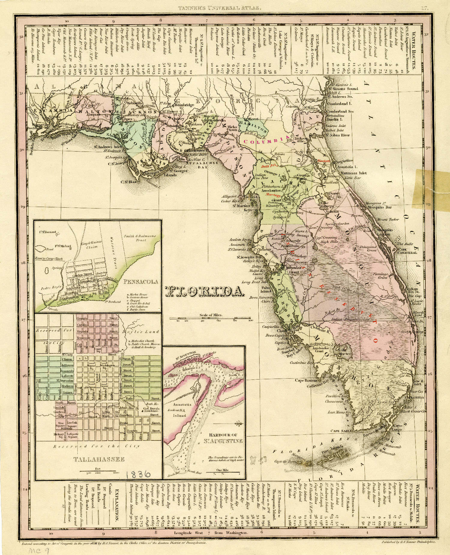
1833 - Florida
TTanner's 1833 map of Florida showing the newly created Columbia county in the north and the Indian Reservation in the south. Also highlight in red: Micanopy in the Arrendo Grant, Dells Post Office became Newnansville, and Picolatti on the St. John’s River.